Designing Structer
The Türkhan autonomous aerial vehicle was developed through a structured engineering process with a strong focus on reliability, autonomous performance, and operational efficiency for the SUAS 2026 competition. The primary objective was to create a lightweight and portable platform capable of autonomously navigating mission areas, detecting victims with high accuracy, and generating mapping data to support search-and-rescue operations.
Digital Design
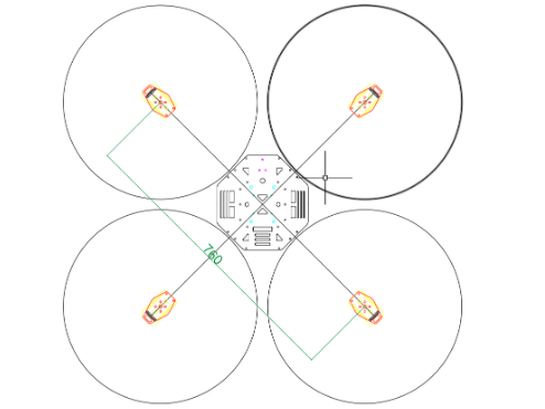
The construction process of Türkhan began with the airframe and component layout design using Autodesk tools to ensure dimensional accuracy, weight optimization, and proper system integration. This digital design phase allowed the team to validate structural balance and assembly requirements before manufacturing.
Carbon Fiber Layup
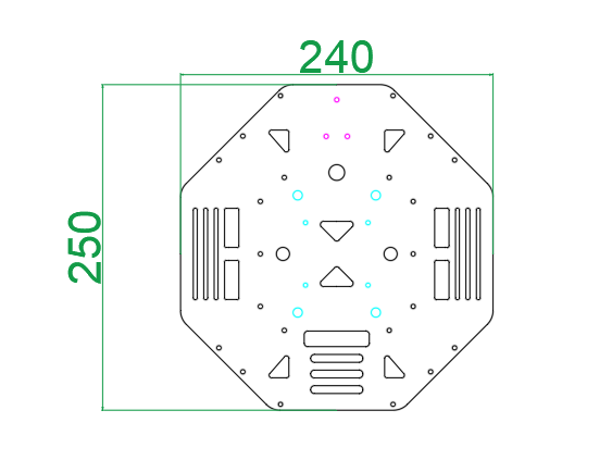
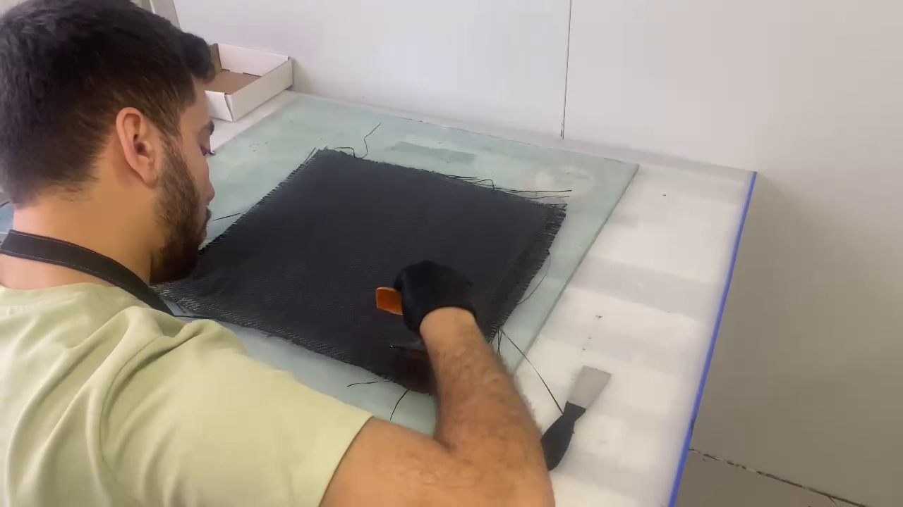
The manufacturing process began with the precise placement of carbon fiber layers according to the designed geometry. Epoxy resin was applied to bond the layers together, creating a lightweight and high-strength composite structure.
Vacuum Process
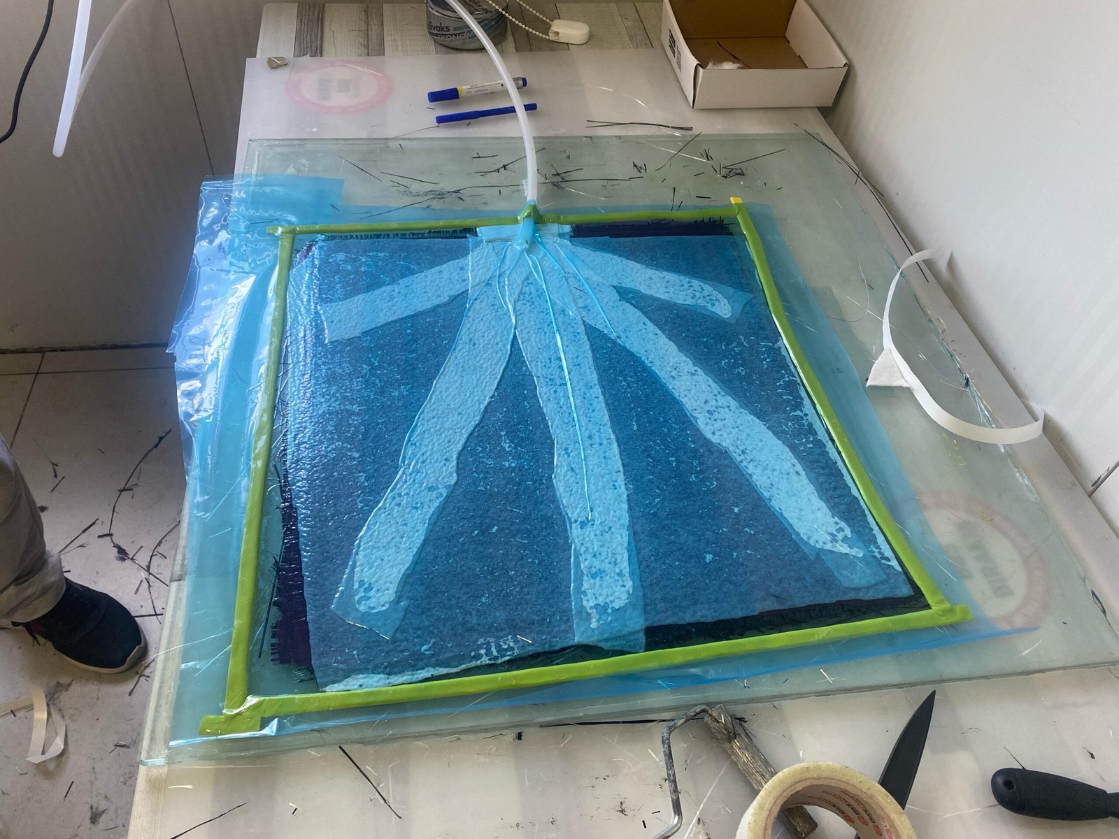
The carbon fiber structure was placed under vacuum to remove excess resin and trapped air. This process improved fiber consolidation and ensured a stronger, more consistent composite structure.
Waterjet Cutting
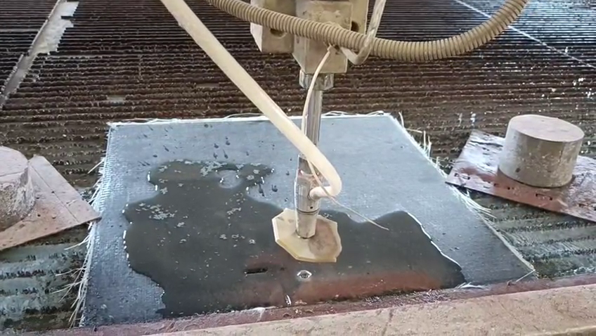
After curing, the carbon fiber panel was precisely cut using a waterjet machine to achieve accurate dimensions and complex geometries while preserving material integrity.
Final Frame
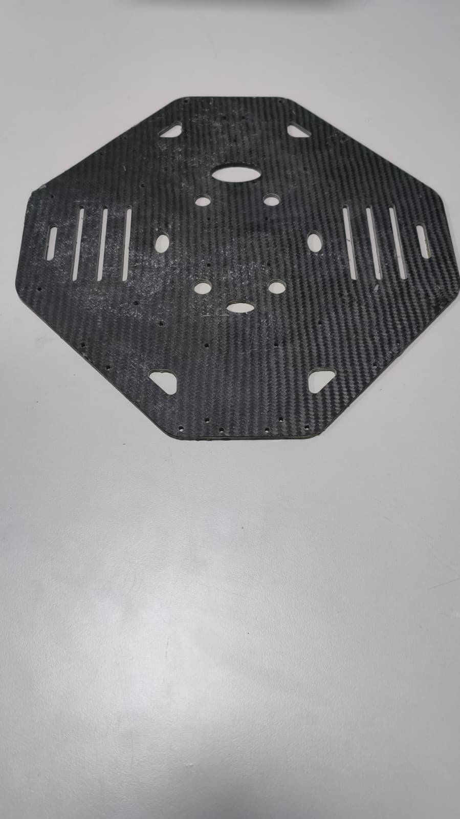
The completed carbon fiber frame was assembled and integrated into the UAV. The final structure provides a strong, lightweight, and durable platform optimized for Türkhan’s flight performance.
See Vehıcle in Action
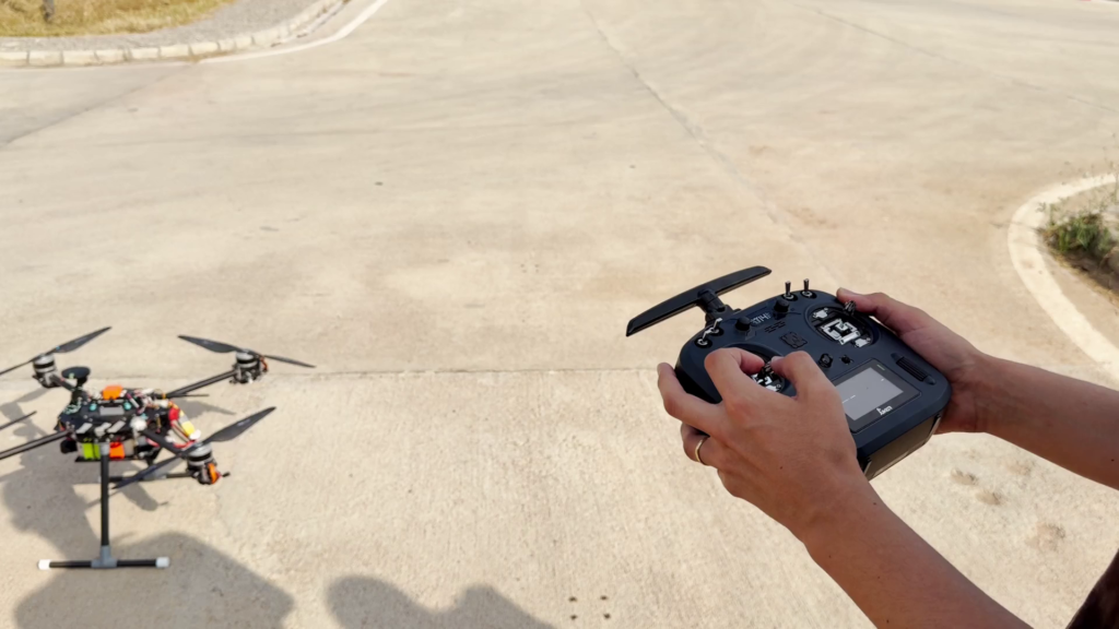
The Flight Test
Designing Delivery System
The payload delivery system is designed to safely release and deliver objects to designated locations after the target detection process is completed. Once the target coordinates are identified, the UAV autonomously navigates to the delivery point and activates the mechanism. The system is designed with a focus on simplicity, reliability, and minimal actuator usage, utilizing a single servo motor to control the release of two payloads. The mechanism allows controlled deployment from an altitude of 65.6 ft while minimizing additional weight and complexity.
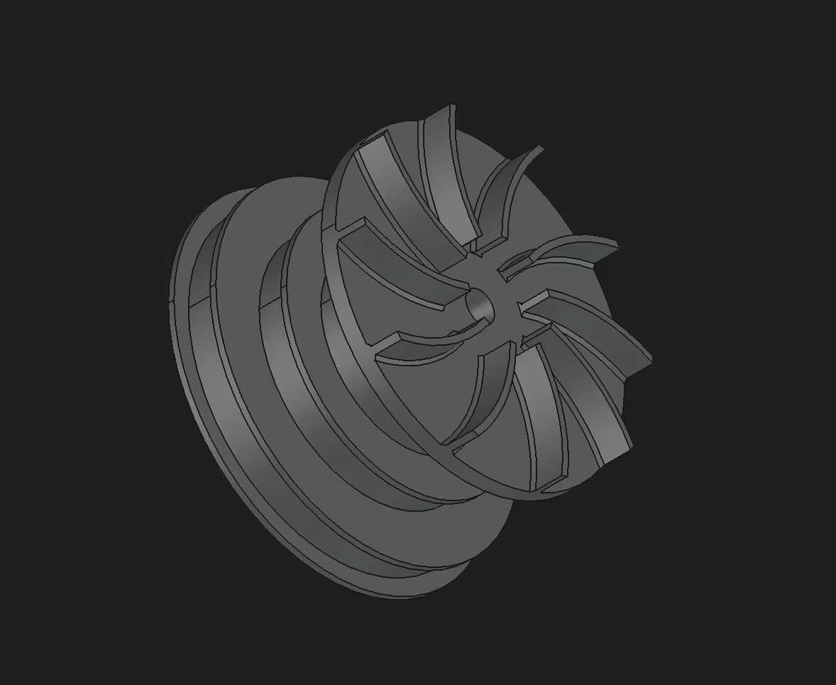
Version 1
The first prototype used torque and drag effects to reduce payload descent speed. However, testing showed that the generated drag was insufficient, resulting in uncontrolled free fall.
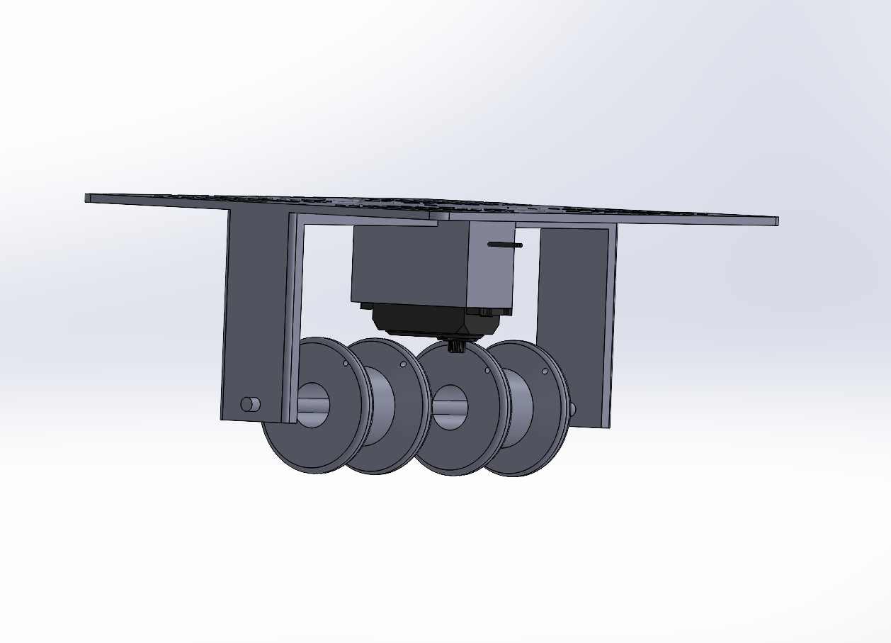
Version 2
The second prototype introduced a rotating damper on the shaft to control pulley rotation. This friction-based design significantly improved descent control and enabled safer payload delivery.
See Delivery in Action
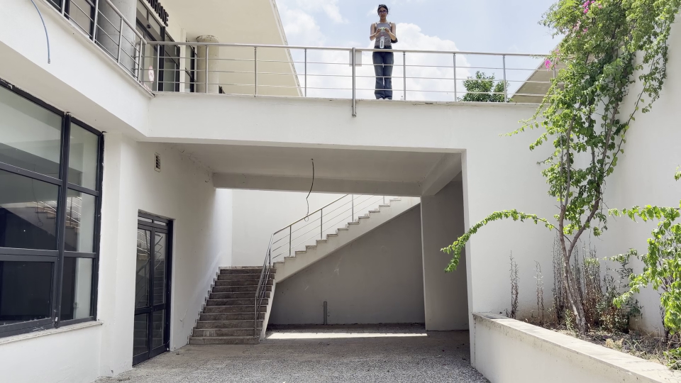
Delivery Mechanism Test
Designing Mission Software
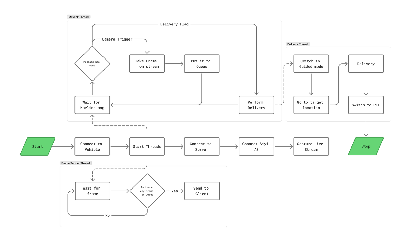
The mission system software of Türkhan was developed using Python to manage autonomous mission execution and communication between onboard subsystems. The communication between the mission computer and Pixhawk is established through the MAVLink protocol using the pymavlink library, enabling reliable flight control and telemetry exchange. The onboard software architecture is based on a server-client structure implemented with the Socket.IO library. The main Raspberry Pi acts as the central server, receiving images captured by the UAV and distributing them to the relevant processing units. This architecture allows independent systems such as target detection and mapping modules to operate simultaneously while maintaining efficient data flow throughout the mission.
Risk Mapping System
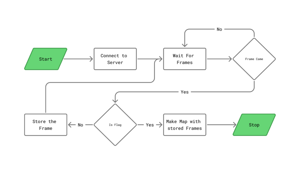
The risk mapping system is designed to generate a 2D representation of the mission area using aerial images collected during autonomous flight. The mapping module continuously listens to the central server for incoming frames through the Socket.IO communication architecture. When a regular image frame is received, it is automatically stored for later processing. Once a predefined flag signal is received, the system recognizes that the image collection phase is complete and initiates the mapping process. The collected images are then processed using OpenDroneMap to generate a detailed 2D map of the search area, providing valuable situational awareness for search and rescue teams.
Target Detection System
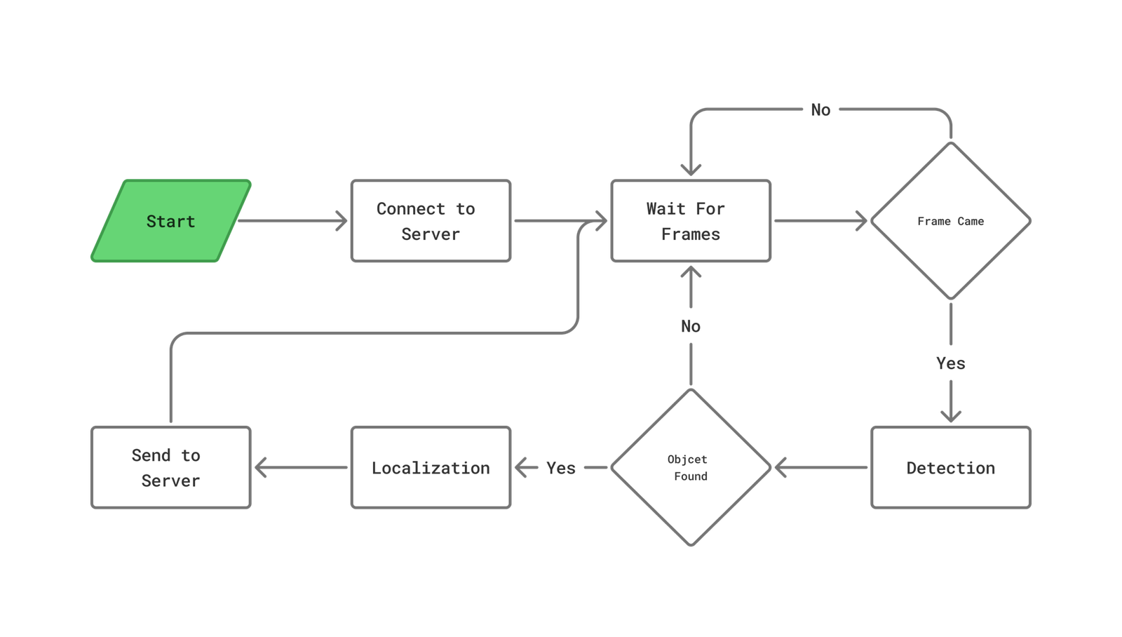
The target detection system continuously listens to the central server for incoming aerial images through the Socket.IO communication architecture. Each received image is processed using the RF-DETR model to identify potential targets within the mission area. Once a target is detected, a localization process is performed to convert the detected position into real-world coordinates. The calculated global coordinates are then sent back to the central server, allowing the mission system to utilize accurate target information for search and rescue operations.
Testing, Simulation, and Validation
Gazebo Simumation
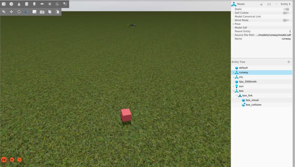
The complete autonomous mission system was tested in both SITL and Gazebo simulation environments to validate system integration and mission performance. During testing, a target was randomly placed within the simulated environment, and Türkhan performed an autonomous grid search mission to locate it. While following the search pattern, the UAV continuously processed aerial images using the target detection system. Once the target was detected, its location was calculated, and the UAV autonomously navigated to the target position to perform the delivery operation. After completing the delivery task, the UAV successfully terminated the mission, demonstrating the effectiveness of the integrated autonomous navigation, detection, localization, and delivery systems.
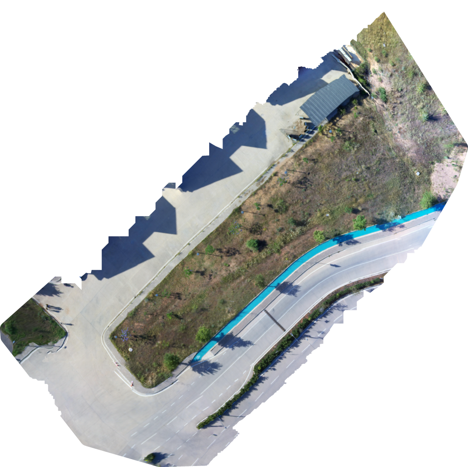
Open Drone Map Tests
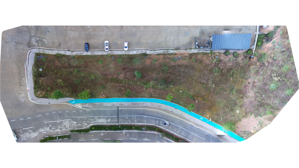
The mapping system was tested using aerial images collected from the flight area in our workshop environment. To evaluate the performance of the mapping process under different conditions, images were captured from various altitudes and with different numbers of photographs. These datasets were then processed using OpenDroneMap to generate 2D maps of the environment. The results were analyzed to evaluate the effect of image quantity and flight altitude on map quality and accuracy.
Model Comparison Test
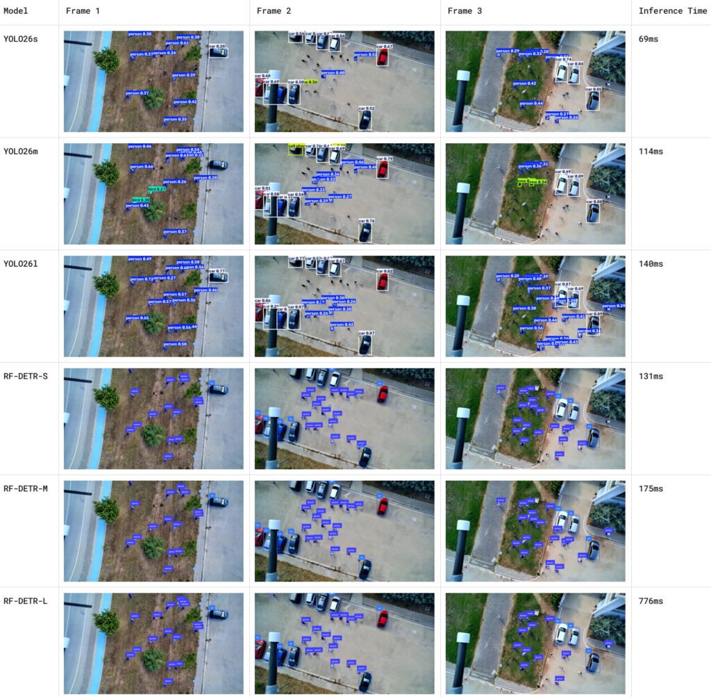
The AI-based target detection system was evaluated using a dedicated dataset to compare the performance of YOLO26 and RF-DETR models. Multiple experiments were conducted using different model weights to analyze their detection capabilities and identify the most suitable configuration for the mission requirements. The evaluation focused on detection accuracy and reliability, helping us select the model that provides the best performance for aerial search-and-rescue scenarios.